

"Main Street of America"
 |
Route 66 window clings sold out The Venice History Committee is planning to erect a metal sign in the civic park near the Venice end of the McKinley Bridge to memorialize Venice's connection with U.S. Route 66 from the highway's commissioning in 1926 through 1936. The story is below.
To help defray the cost of the sign and installation, black and white window clings were being sold to be displayed proudly inside on the rear window of vehicles, so everyone can show their connection to Venice and Route 66.. Thanks to everyone who purchased one or more clings. Your support allows the Committee to continue its work of collecting and disseminating the history of Venice to everyone. |
|
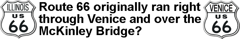
Route 66 sign will tell visitors of the highway's link to Venice 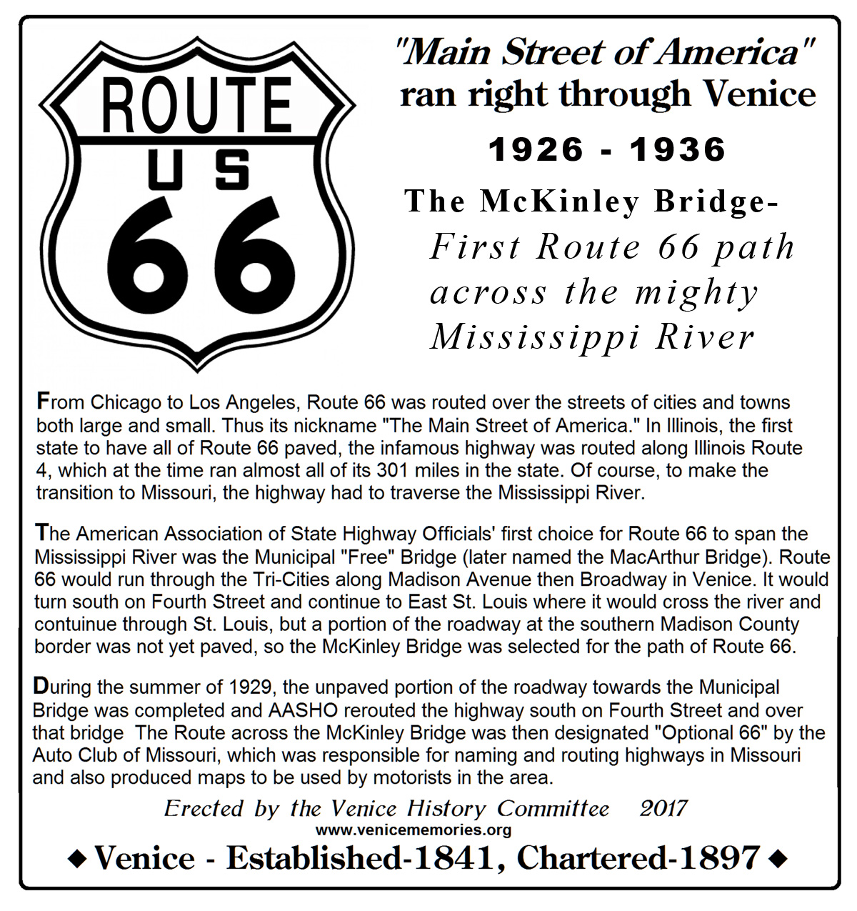 "Main Street of America," U.S. Route 66, once ran right throught Venice and over the McKinley Bridge. A metal sign, approximately 24" x 28", will be erected by the VHC in the small civic park near the Venice end of the bridge to memorialize Venice's link to the famous highway from the time it was commissioned.
 |
  Everyone remembers that Illinois Route 3 runs through Venice and has for many years, BUT did you know that when Route 66 was conceived and eventually commissioned on Nov. 11, 1926, that it, too, was routed through Venice? From Chicago to Los Angeles, Route 66 was routed over the streets of cities and towns both large and small. Thus its nickname "The Main Street of America." In Illinois, the first state to have all of Route 66 paved, the infamous highway was routed along Illinois Route 4, which at the time ran almost all of its 301 miles in the state. Of course, to make the transition to Missouri, the highway had to traverse the Mississippi River. 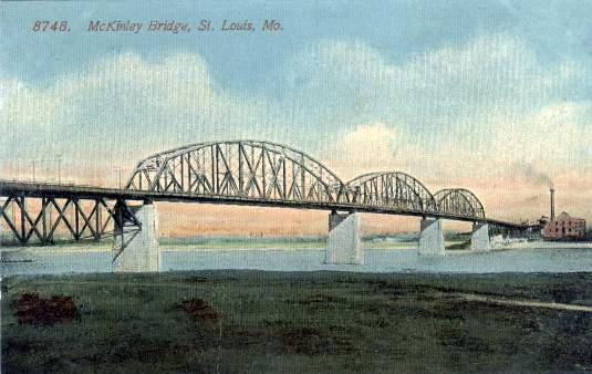 The American Association of State Highway Officials (AASHO) was the organization responsible for the numbering and routing of U.S. and state highways while working with the state highway departments. It is also the group that initiated the use of even numbers for east-west roads and odd numbers for north-south roads.
AASHO looked to the St. Louis area to decide where Route 66 should cross the river and their first choice was the Municipal (Free) Bridge (it's name would be changed in 1942 to honor General Douglas MacArthur), but there still was approximately 1.25 miles of unpaved roadway on the southern border of Madison County so that path was not possible. The McKinley Bridge was their second choice, but it secured Route 66 to run through Venice. At the beginning, Route 66 came out of Edwardsville on what is now Illinois 157. At the present intersection with the entrance road to Southern Illinois University at Edwardsville, it continued west on Chain of Rocks Road, eventually passing the Luna Cafe in Mitchell then continued down Nameoki Road until it turned right onto Madison Avenue and passed the then new Granite City Community High School. It continued along Madison  Avenue through Granite City and Madison then curved to the right and over a number of railroad tracks onto Broadway. (The first viaduct over the tracks wasn't built until 1938.) It continued along Broadway passing the City Hall, then across more railroad tracks, turning left onto Main Street towards the McKinley Bridge approach. On the west side of the bridge, motorists travelled on Salisbury Street and points westward.
During the summer of 1929, the unpaved portion of the roadway towards the Municipal Bridge was completed and AASHO rerouted the highway over that bridge, but Route 66 still ran through Venice. At the intersection of Broadway, Klein Street and Fourth Street, Route 66 turned south and ran on Fourth Street towards Brooklyn then East St. Louis and the Municipal Bridge. The Route across the McKinley Bridge was then designated "Optional 66" by the Auto Club of Missouri, which was responsible for naming and routing highways in Missouri and also produced maps to be used by motorists in the area. Eventually in 1935, after the completion of the Chain of Rocks Bridge across the Mississippi, Route 66 was once again rerouted to run that bridge and the Municipal Bridge was marked "City 66." No information has been found to indicate when the "Optional 66" designation for the McKinley Bridge route was discontinued, but it is clearly a fact that "The Mother Road" did run right through the center of Venice for almost 10 years. 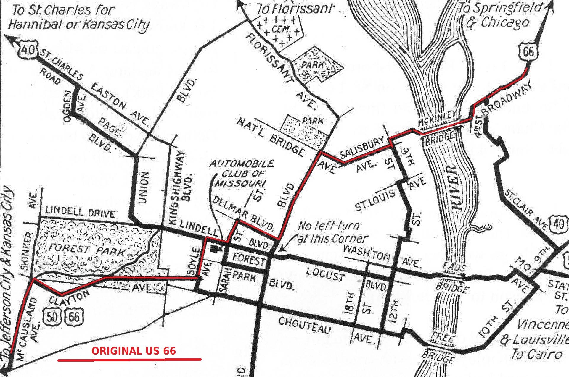
 |

|
Here is a link to a page featuring a mosaic of aerial photos of about 10 miles of Route 66 in 1941. |
|